Location services, fundamentally, rely on two components- a mapping system and a positioning system. The mapping system provides the physical map of the space, and the positioning system identifies the position within the map. Outdoor location services have thrived over the last couple of decades because of well-established platforms for both these components (e.g. Google Maps for mapping, and GPS for positioning). In contrast, indoor location services haven’t caught up because of the lack of reliable mapping and positioning frameworks, as GPS is known not to work indoors. WiFi positioning lacks maps and is also prone to environmental errors. In this paper, we present DLoc, a Deep Learning based wireless localization algorithm that can overcome traditional limitations of RF-based localization approaches (like multipath, occlusions, etc.). DLoc uses data from the mapping platform we developed, MapFind, that can construct location-tagged maps of the environment. Together, they allow off-the-shelf WiFi devices like smartphones to access a map of the environment and to estimate their position with respect to that map. During our evaluation, MapFind has collected location estimates of over 120 thousand points under 10 different scenarios across two different spaces covering 2000 sq. Ft. DLoc outperforms state-of-the-art methods in WiFi-based localization by 80% (median and 90th percentile) across the 2000 sq. ft. spanning two different spaces.
DLoc is a Deep Learning based wireless localization algorithm that can overcome traditional limitations of RF-based localization approaches (like multipath, occlusions, etc.). DLoc uses data from the mapping platform we developed, MapFind, that can construct location-tagged maps of the environment. Together, they allow off-the-shelf Wi-Fi devices like smartphones to access a map of the environment and to estimate their position with respect to that map. During our evaluation, MapFind has collected location estimates of over 150 thousand points under 10 different scenarios across two different spaces covering 2000 sq. Ft. DLoc outperforms state-of-the-art methods in Wi-Fi-based localization by 80% (median & 90th percentile) across the 2000 sq. ft. spanning two different spaces.
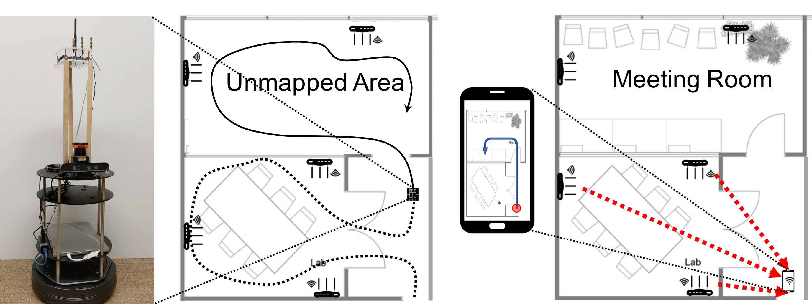
MapFind (left) is an autonomous platform that maps an indoor environment while collecting wireless channel data. The platform generates a detailed map of the environment and collects training data for DLoc. DLoc uses the training data to learn a model to accurately localize users in the generated map.

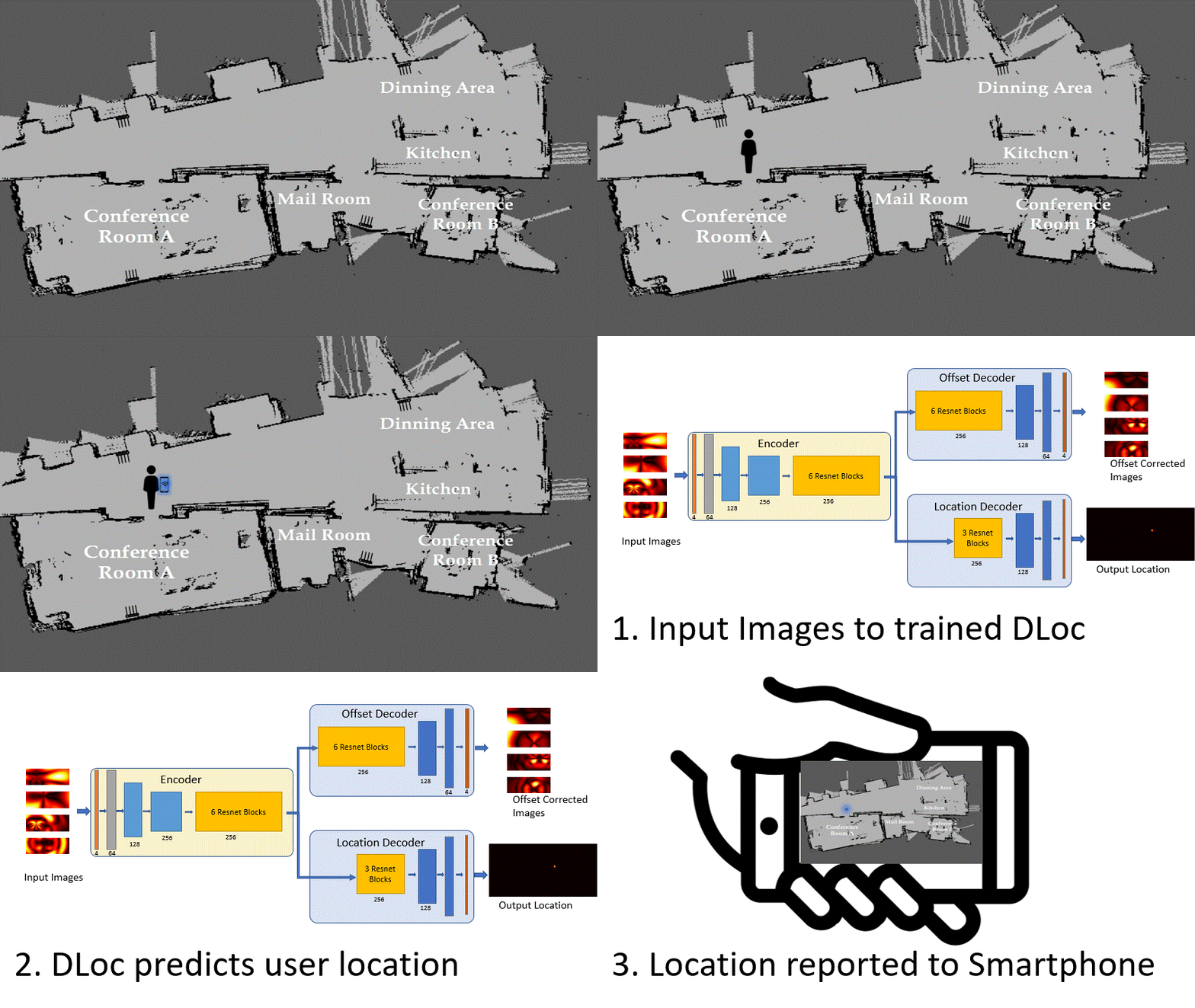
Once DLoc has been trained using the data collected from MapFind. Any new user entering the environment can use their smartphone to estimate their location with the help of the trained network.

DLoc uses data from the mapping platform we developed, MapFind, that can construct location-tagged maps of the environment. Together, they allow off-the-shelf Wi-Fi devices like smartphones to access a map of the environment and to estimate their position with respect to that map. During our evaluation, MapFind has collected location estimates of over 150 thousand points under 10 different scenarios across two different spaces covering 2000 sq. Ft. DLoc outperforms state-of-the-art methods in Wi-Fi-based localization by 80% (median & 90th percentile) across the 2000 sq. ft. spanning two different spaces.

|
|